Smoky Mountains 2021
Sunday morning, I woke up early and alone, I had already dropped Sassy off at a dog sitter the previous night. Bags were already in the car, I got dressed and got into the car to drive to the airport. I parked at EZ Air Park and took their shuttle to the airport. I dropped my checked bag off at the counter, headed through security, and bought some Dunkin Donuts before waiting at my gate.
When it was time to board, I gave the gate agent my first-class ticket and took my seat in the front row with ample leg room for a short flight to Chicago to get a connecting flight from there. The only reason I had a first-class ticket was because when I initially booked the flight it was before the pandemic while prices were still extremely high. I had to cancel the trip and they gave me credit, which was almost enough to cover a first-class ticket.
While on the flight I spoke with the male flight attendant who was from where I was going, and we had a good conversation. He lived near the Blue Ridge Parkway which goes through the Smokies. It is a scenic 469 mile drive. We talked about the area and things to do. I did not have time to do any of the things he recommended. When I got to O’Hare, I had to go from one end of the terminal to the other to catch my next flight to Knoxville.
Knoxville is the closest airport to the Smoky Mountains which is the whole reason for my trip. The second flight was on a pretty small plane, so it was a little bumpy. My ears popped a lot while on this fight. The plane landed without issue. I grabbed my checked bag, picked up my rental car, and drove to the Nantahala Outdoor Center (NOC).
The drive is about two hours through mountains, including, what I would later learn, the Tail of the Dragon. Tail of the Dragon is a road through the mountains with 318 curves over 11 miles that is popular among sport car enthusiasts and motorcyclists. There are several areas to pull over which I did often because sports cars and motorcycles come up behind you around hairpin turns and tailgate you. My hands were gripping the wheel tightly as I nervously tried to navigate these 11 miles of mountain roads.
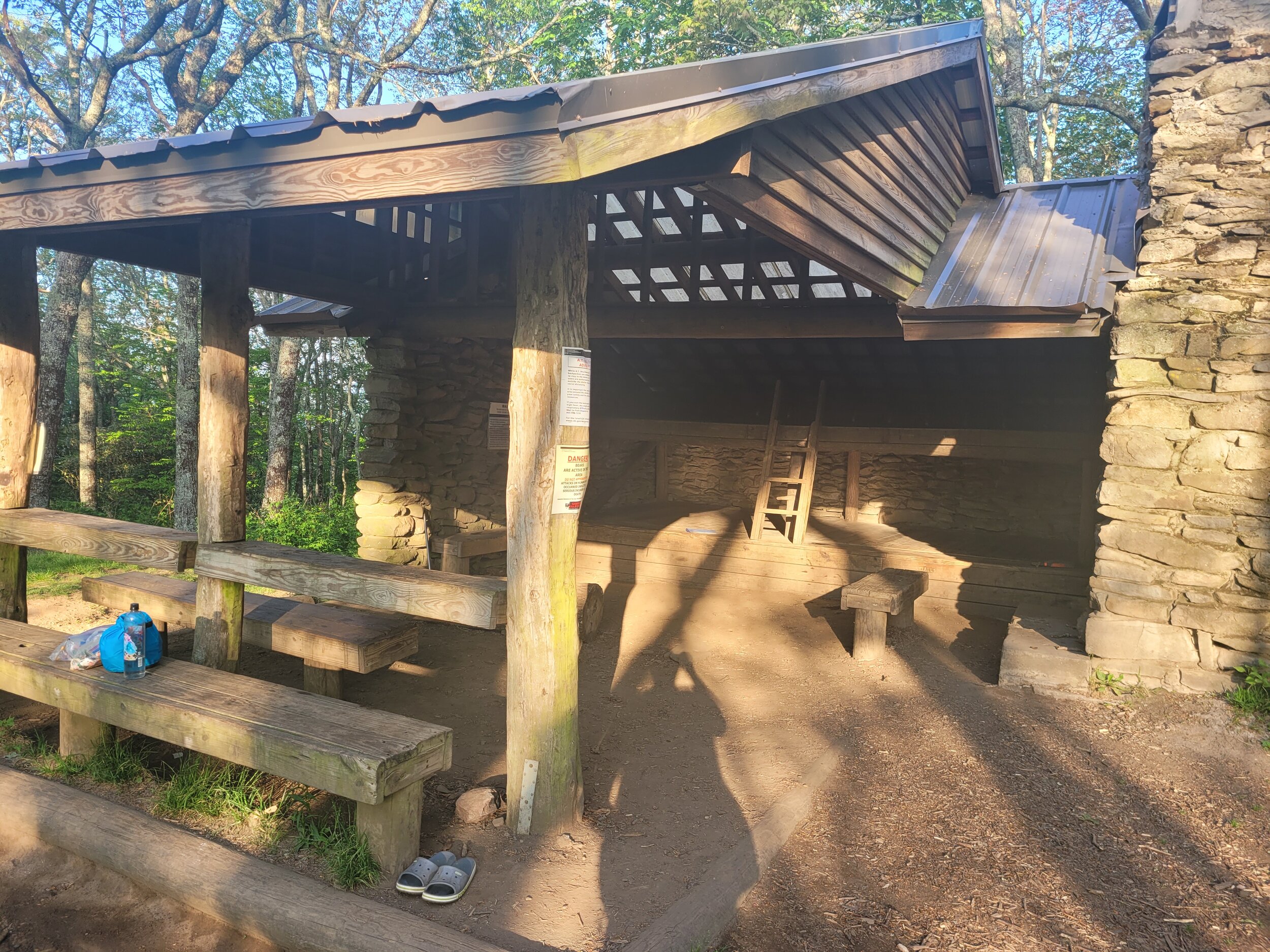
I finally made it to the NOC, A destination popular among kayakers going down the Nantahala River. There is an outfitter, a couple restaurants and some bunk housing, which is my reason for going there. I checked in at the general store where they give me the key to my lodging that night and I entered the room. It has very basic accommodations, four bunk beds with prison style mattresses. Guests must provide your own sheets and pillows. If anything can be said, it was affordable lodging for the night.
Then I went to grab some food at one of the restaurants on the property only to find out that the only thing they can make that day is pizza because of issues in the kitchen, so pizza it is! While waiting for my dinner, I was able to look out at the river and see kayaker’s and rafters go down the river. What really caught my eye was the fact that there was a kid, under the age of 8 by the looks of it, who was handling the river so easily, navigating around rocks and rapids. I paid $16 for a small pizza and soda that quite frankly was not very good. Perhaps if I were out hiking for a few days prior, I would think differently of the pizza. I walked back to my room for a night's sleep.
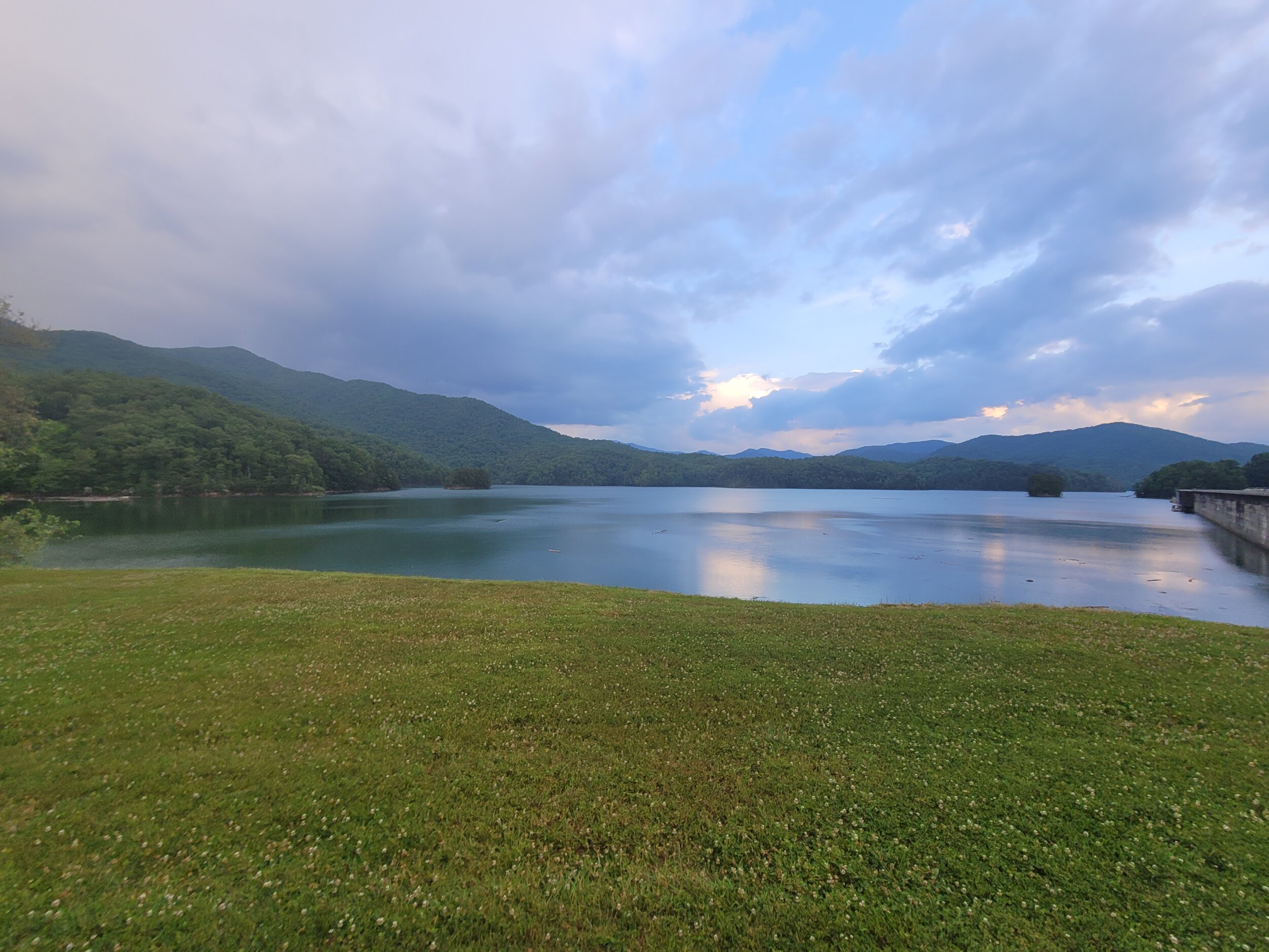
The next morning, I woke up early to eat breakfast and meet my shuttle at 9am at Fontana Dam. I drove a half hour in the dark to order a waffle and a couple of sausage patties from a southern cultural icon, the Waffle House. The waffle was very nice, but the sausage was nothing special. Overall, it was decent food. I paid up and drove off to Fontana Dam.
At the dam I saw some Canadian Geese which reminded me a bit of home in Minnesota. As I waited for the shuttle to arrive, a couple thru-hikers came by. I was surprised to see them this late in the year. I would later see a whole lot more. A thru-hiker is someone who sets out to hike the entire Appalachian Trail (AT). The Appalachian Trail runs all the way from Mount Springer, Georgia to Mount Katahdin, Maine. To thru-hike the whole trail is to hike nearly 2200 miles over a period of about five months typically. I will only be doing about 40 miles from Newfound Gap to Fontana Dam.
The shuttle was driven by Ranger Bob. Bob used to be a park ranger for the Smoky Mountains, He is now retired and drives shuttles, what more, Bob recognized me from my 2018 trip. I hopped in his van and off we went. We talked about the company he works for now, what it was like working for the park service, about curing meat and making sausage (he used to work at a meat counter) along with a variety of topics on our two-hour ride to Newfound Gap. The conversation made the time fly by.
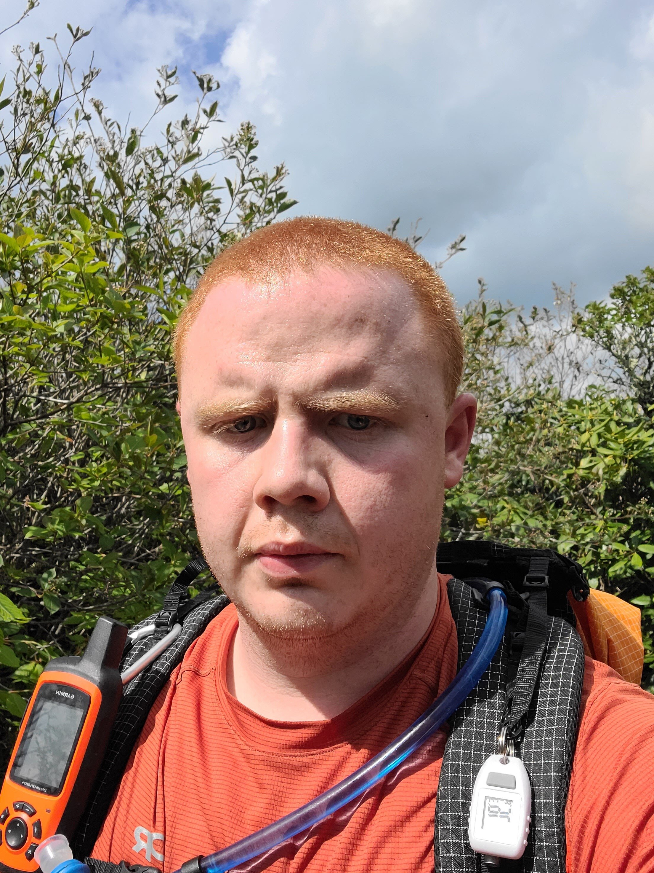
Newfound Gap was loaded with tourists taking photos of the beautiful scenery. I got out of the van. Ranger Bob opened up the back of the van, so I could get my gear. I grabbed my backpack and asked, "Which way is my car?" He pointed me to the southbound directions of the Appalachian Trail.
A Quick note on terminology, or at least how I am using these terms:
Thru-hiker - Someone who plans to hike the entire 2200 miles of the trail in a single year.
Section Hiker - Someone who plans to hike multi day sections, like me.
Day Hiker - Someone who is out for the day and will be sleeping in a nice comfy bed that night, but they are getting away from the tourist hotspots.
Tourist - Someone who pulls up in a parking lot and does not go far from their car.
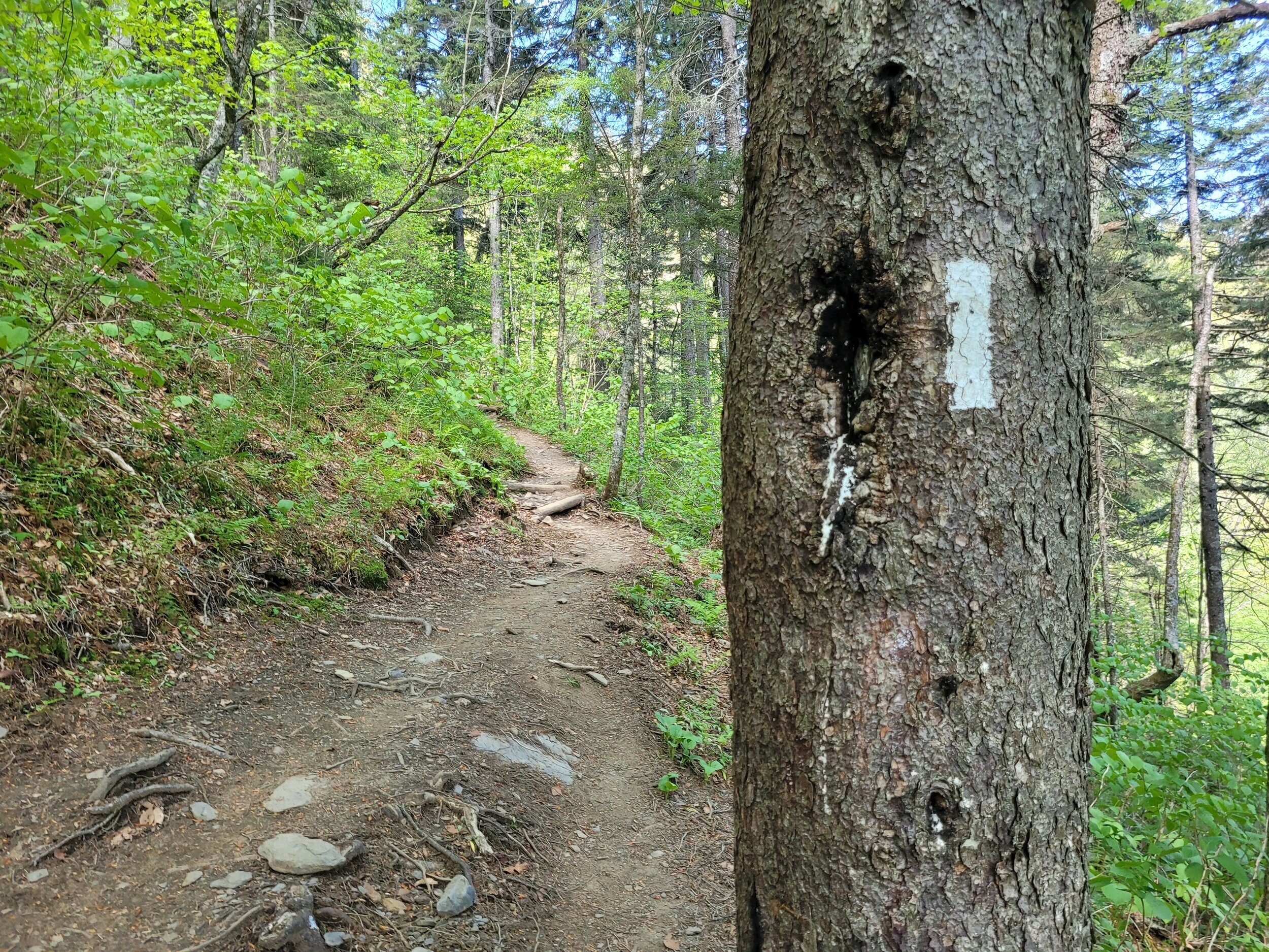
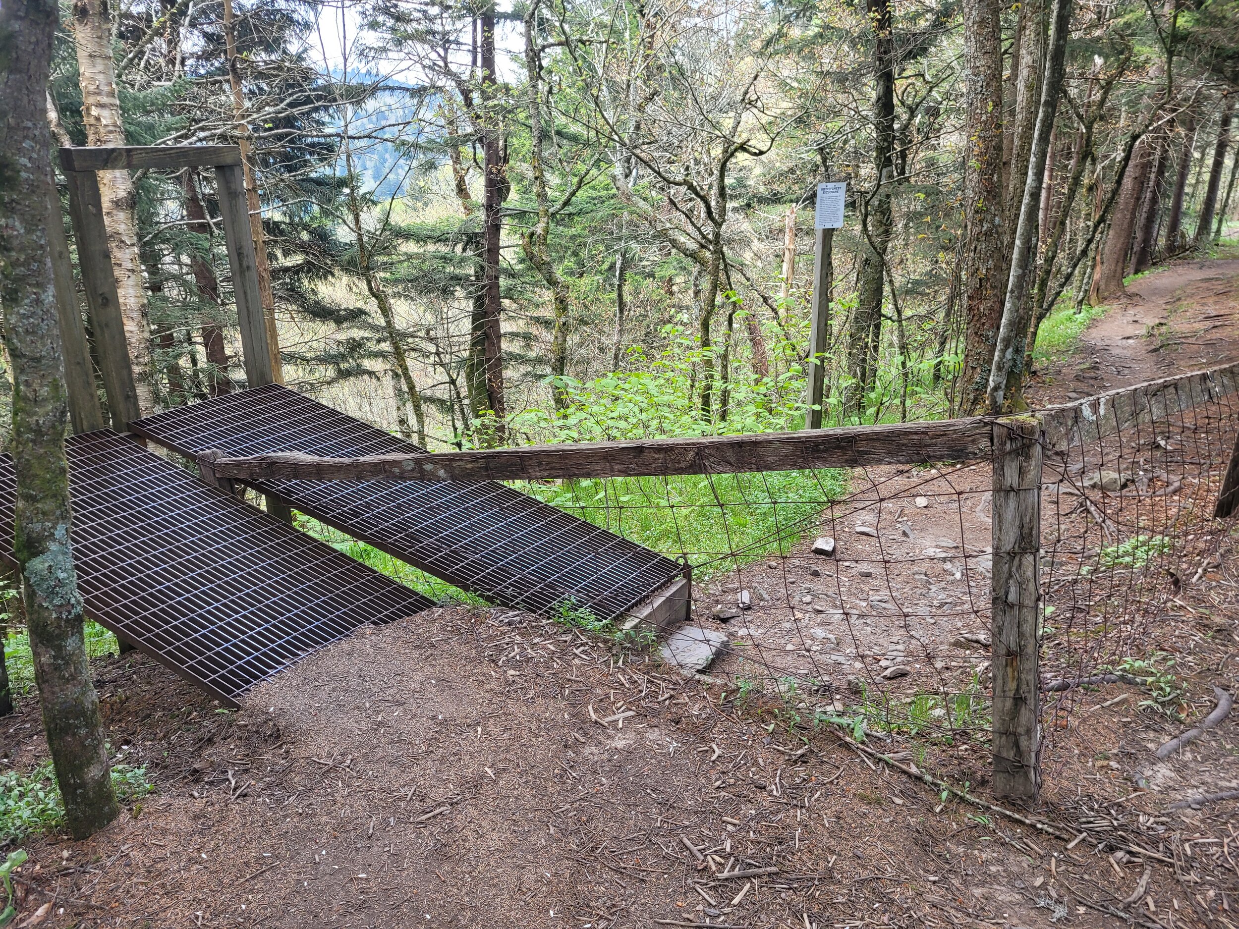
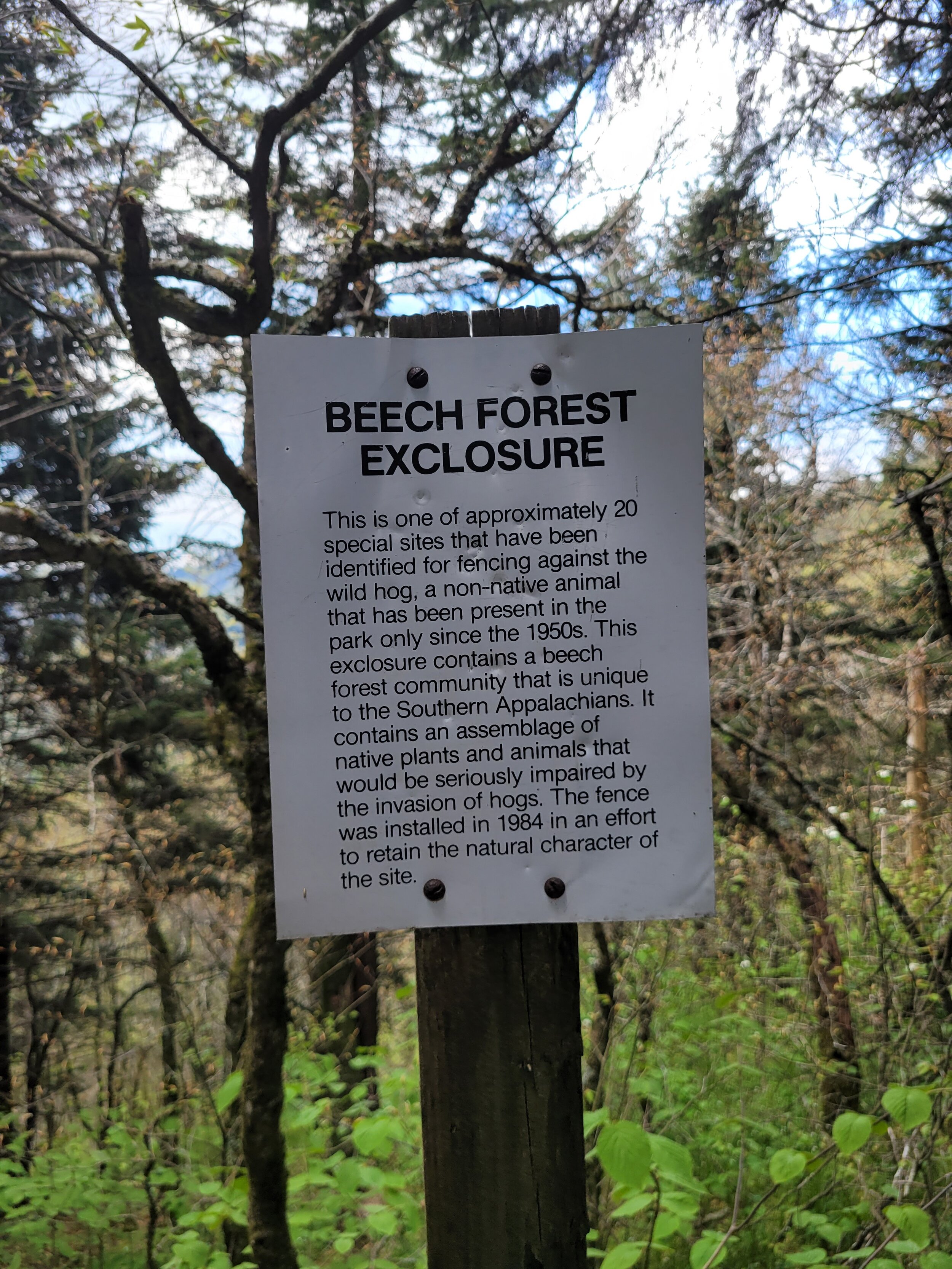
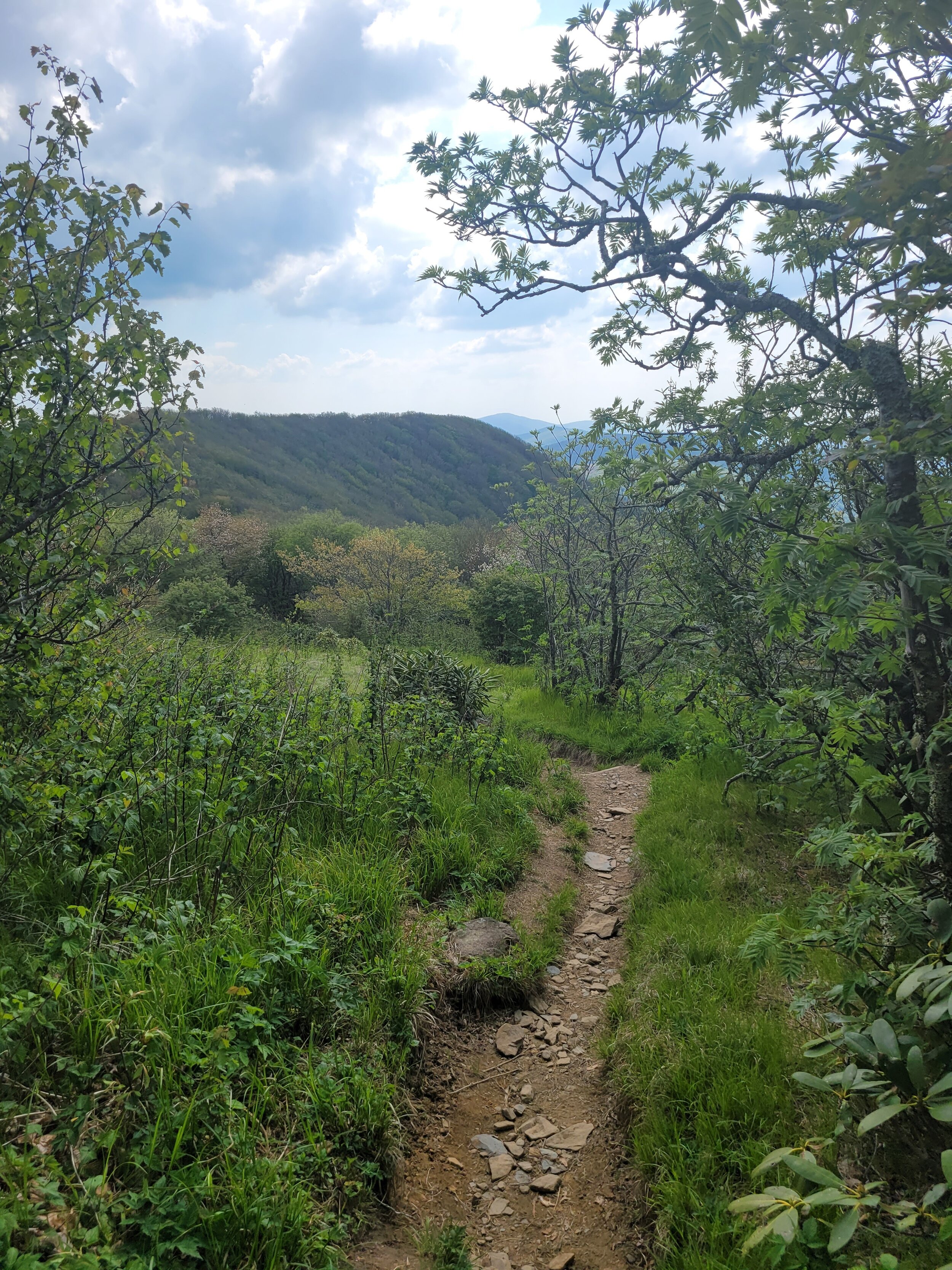
I hiked down from the parking lot and come across my first white blaze. A white blaze is painted on trees to let hikers know they are on the right trail. It is not very long before I run into several more thru-hikers. We chat about their experience a bit, but we move on after a minute or two. I felt fresh and excited to be out on the trail, making good time. I came across some wild boar exclusion gates, a gate that is designed to keep the wild boar population from destroying beech trees. The gate is different as it consists of two ramps that you have to walk up one side and down the other. Unlike most gates, there is nothing that swings open. Wild boar will not climb up the ramp so it is effective at keeping them out of the protected area.
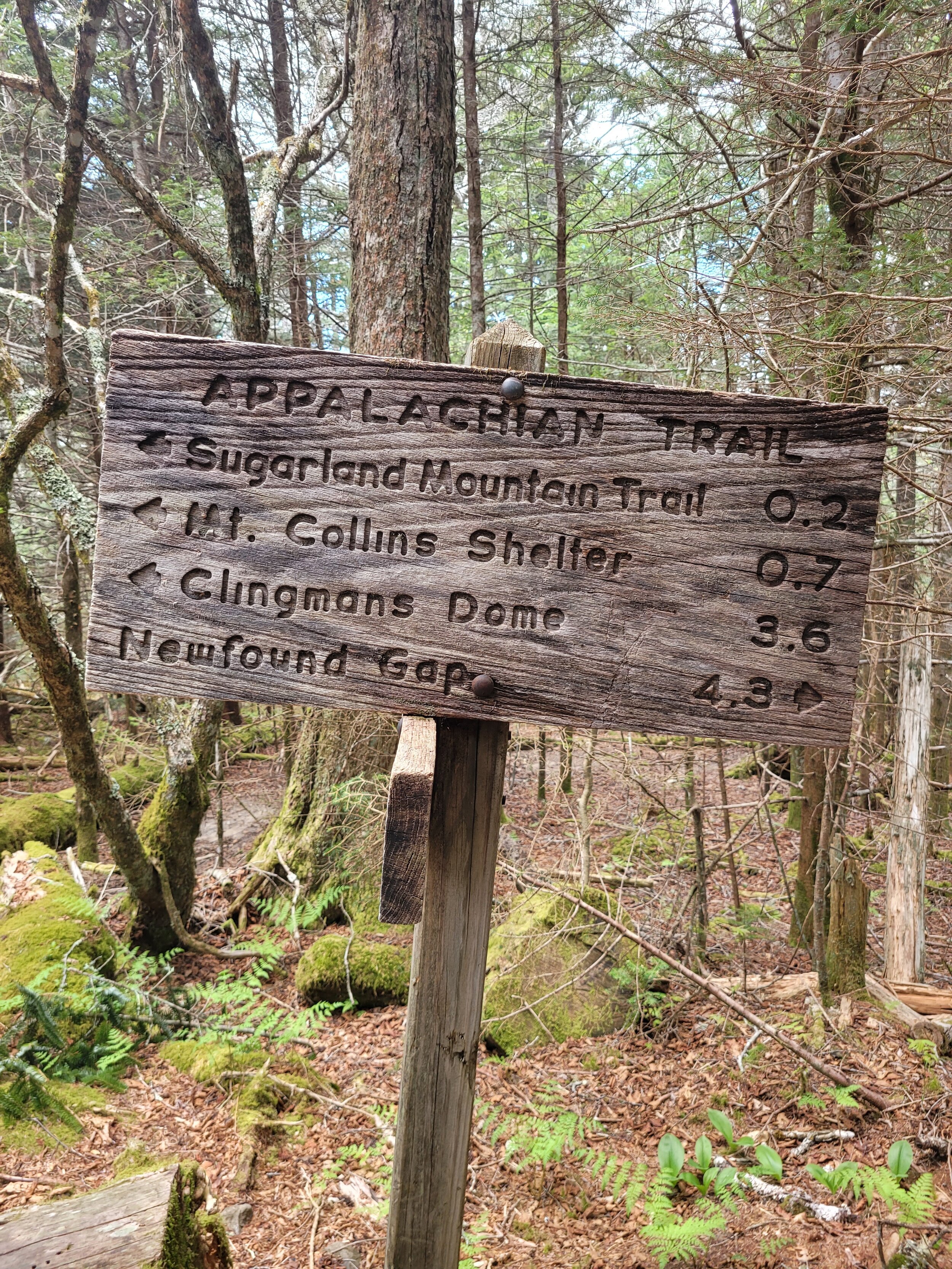
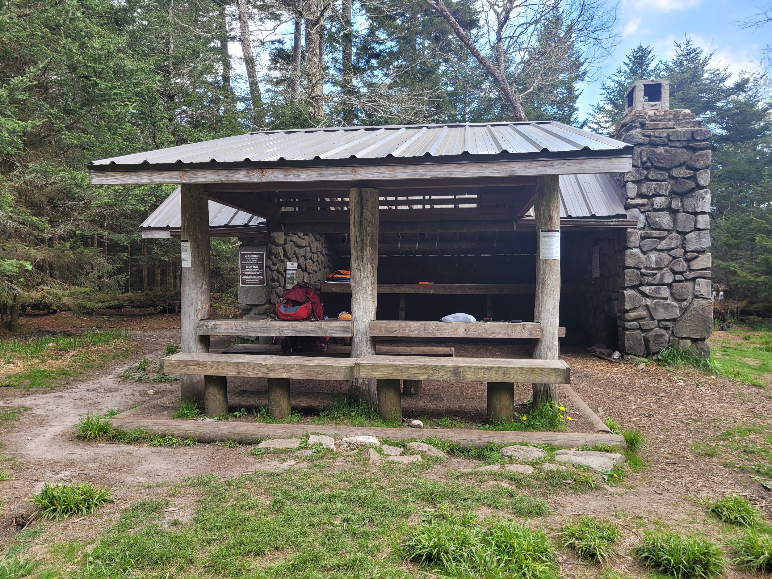
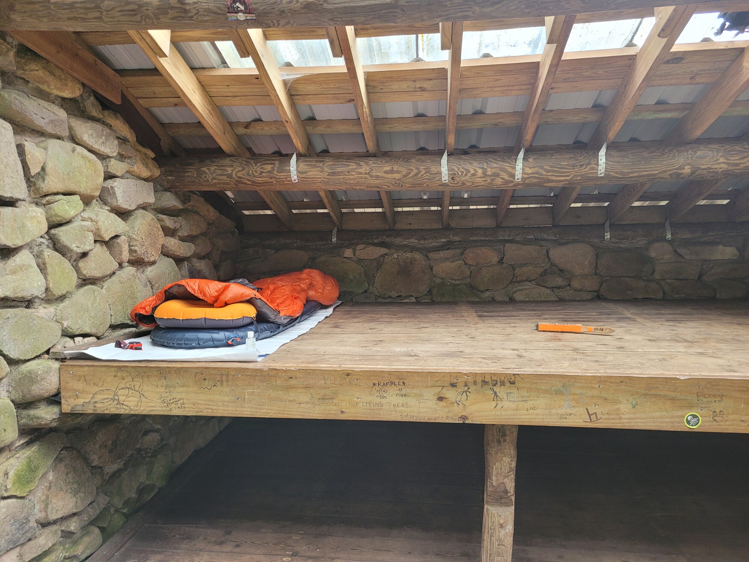
After an easy 5-mile hike, I arrived at Mt Collins Shelter, which is 0.5 miles off the main trail. A man in his 50s was smoking in the shelter when I arrived. He told me he was a roofing contractor from Florida and that he'd taken some time off, because it was hard to find people to work for him. He blamed it on all the stimulus and people not wanting to work. Although, from my interaction with him, I think a better explanation is that no one wants to work for him.
We were joined by more people including a group of five. Two were ministers. We had a great night and lots of good conversation from that point on. I even got a good book recommendation, A Stranger in the Woods, which I am listening to now. It is about a man in the Maine wilderness who survived for 27 years by stealing what he needed, nothing of value, to survive. He was caught in 2013.
More people came, including thru-hikers. The shelter area ended up getting fairly full, but due to covid many people opted to stay in their tents outside the shelter as permitted by the park service. Inside the shelter was only me and the five people from the group of ministers.
The following morning, I ate breakfast and headed out. I hit the trail around 7:30 am after eating my breakfast and going to the bathroom. I noticed I may have not packed enough toilet paper, but I could probably fix that today.
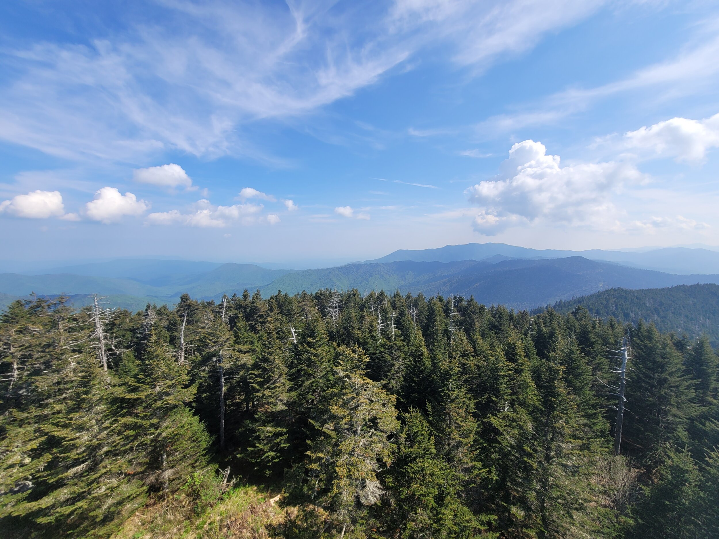
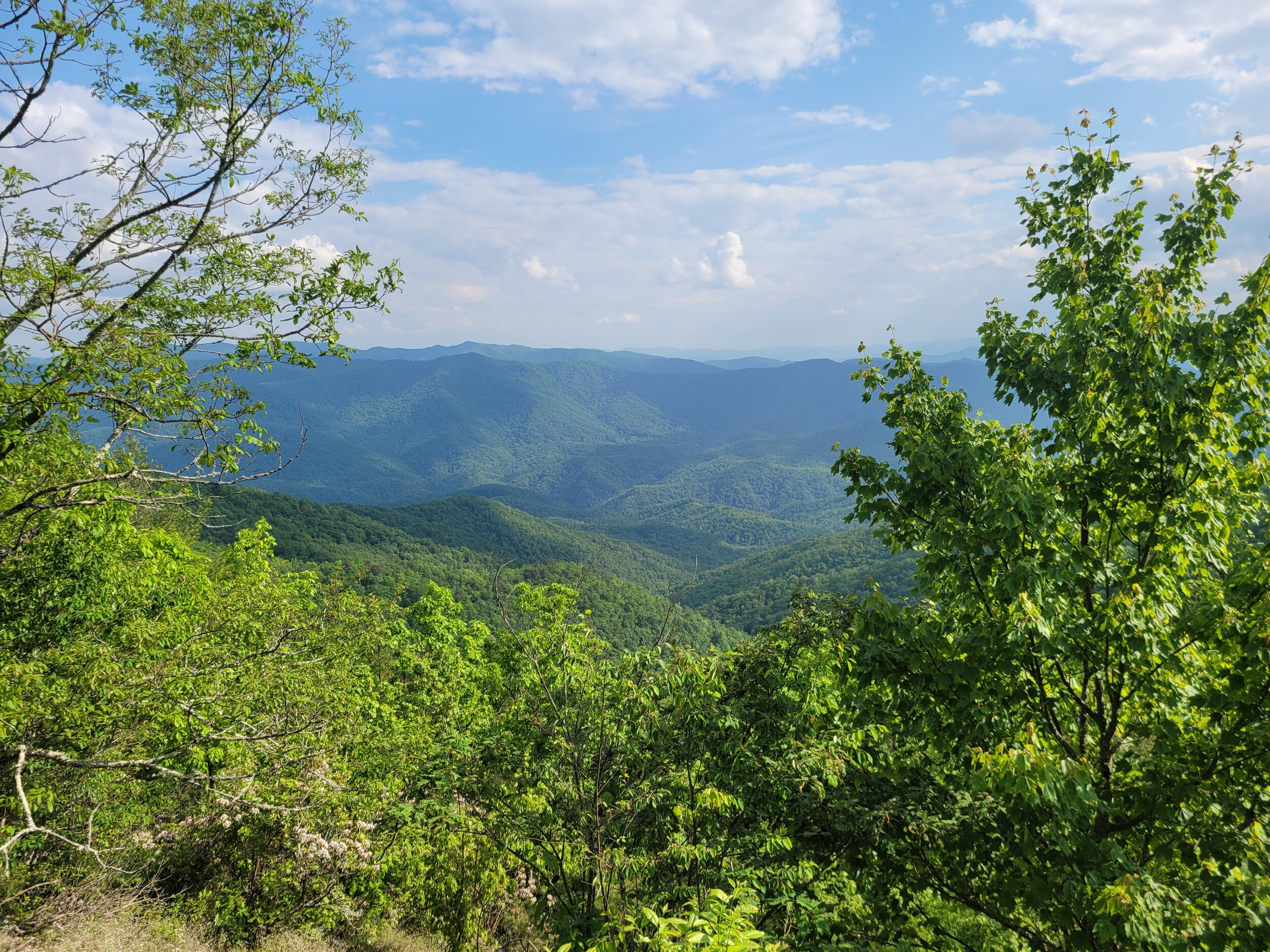
I started my ascent to Clingmans Dome. Clingmans Dome is a concrete tower with a spiraling ramp to the top. It is the highest point on the entire AT and in Tennesee. When I arrived at about 10 a.m., it was full of tourists walking up the steep paved trail to get to the top of the tower. I climbed to the top of the tower and had a look around at the 360-degree view.
When I got back down to the base of the tower, a tourist asked me where the trail that I'd just come off of leads. I pointed in the southbound direction and told him “That that way leads to Mt Springer, Georgia.” Then I pointed to the northbound trail and said, “and that way leads to Mt Katahdin, Maine, but you will hit Newfound Gap first.” I use the terms northbound and southbound as the trail does not go strictly north, or south all the way through the Smokies. It goes more of a southwest to northeast direction.
I then walked down to the parking lot. The AT drops you off at the base of the tower, it is another half mile down hill to the parking lot.
The interactions with tourists are always odd. They are often oblivious that people go backpacking out there and sleep in the woods. They are even more stunned to learn that people thru-hike. One individual I met at the shelter the night before told me it was his first backpacking trip, and when he got started on his trip people thought he was a Bear Grylls type person. Most backpackers you will meet are far from a Bear Grylls survival kind of person. Bear Grylls is a popular celebrity mostly for his show Man vs Wild where he would be dropped off in the middle of nowhere with no supplies and would have to survive for several days with nothing other than what he had on him.
I walked a half mile downhill on a paved surface to a parking lot where I could throw away my trash from the night before and use the outhouse. I planned to roll up some of the toilet paper from the outhouse provided by the park service and use that if I ran out. As luck would have it, they had placed a spare partial spool on the handicap bars, so I stuffed that in my bag and made a quick bathroom visit.
I found some shade, which was kind of hard to find there, and ate my lunch. I watched tourists struggle up the hill.It was hard for me to climb up, but at least then I was not on a wide paved path. At times, I had to use my hands and legs to climb up steep rocks with a backpack containing everything I would need to survive for 3 more days.
I remember seeing a sign warning not to take wheelchairs or strollers up the path as it is dangerous. Sure enough I saw a family with an electric wheelchair bound child try to go up the hill. The child asked her family if they needed a break going up. Shortly after that her wheelchair died. I assume the motor overheated. The family waited a bit. Then, they continued to press on only to have the wheelchair quit a few more times. I left shortly after to continue my journey.
Looking at the map there appeared to be a trail that would cut a little bit of my trip off coming out of Clingmans Dome. Instead of hiking back up the paved trail, I could take a trail by the parking lot that met up with the AT. It turned out this trail was far more difficult and did not really save any time because of how rugged it was. The idea was to shave off 0.2 miles of the AT and not have to climb so high.
Now that I was back on the AT around noon, it was very hot, worse yet, I was exposed to direct sunlight. The AT is often called the green tunnel, but there was no green to stop the sun’s rays this time. I was miserable under the noon heat and direct sunlight. The thermometer on my backpack at times read close to 80 degrees at elevation. My sunscreen was deep in my pack and I did not want to dig it out. My foolishness got me sunburnt.
As the trail descended, I finally got some tree cover and things started to cool off. I met two college-aged girls who looked like they may have bitten off more than they could chew. They packed very lightly for a day hike and were at least 10 miles from where they started, Elkmont. They were excited to see me as they had not seen another human in a while. I felt the same way. They wanted to know how far Clingmans was. I told them it was about 1.6 miles away. They were planning on going to Clingmans and see if they could hitch a ride or call for one to get them out of there. I wished them well and carried on my way.
I passed by a woman from South Africa, who was hiking as much of the trail as she could in three months. I hope she has much success on her trip.
I then came across a couple who were backpacking for the first time. They were cheery and seemed to be having a good time, but they were definitely struggling. We would play leapfrog a for a while, and they even took my photo for me. It would sprinkle a bit at the end of the day’s hike, but it was never enough to feel refreshing. Eventually, I got ahead of them and reached my next shelter, Silers Bald. I was getting things organized for the night when they passed by.
Silers Bald Shelter was my least favorite shelter on the AT. The water source was precarious to get to, to make matters worse it was little more than a trickle, but I was able to fill up my bottles for filtering and hike back up. The worst part of this shelter is that it has no privy.
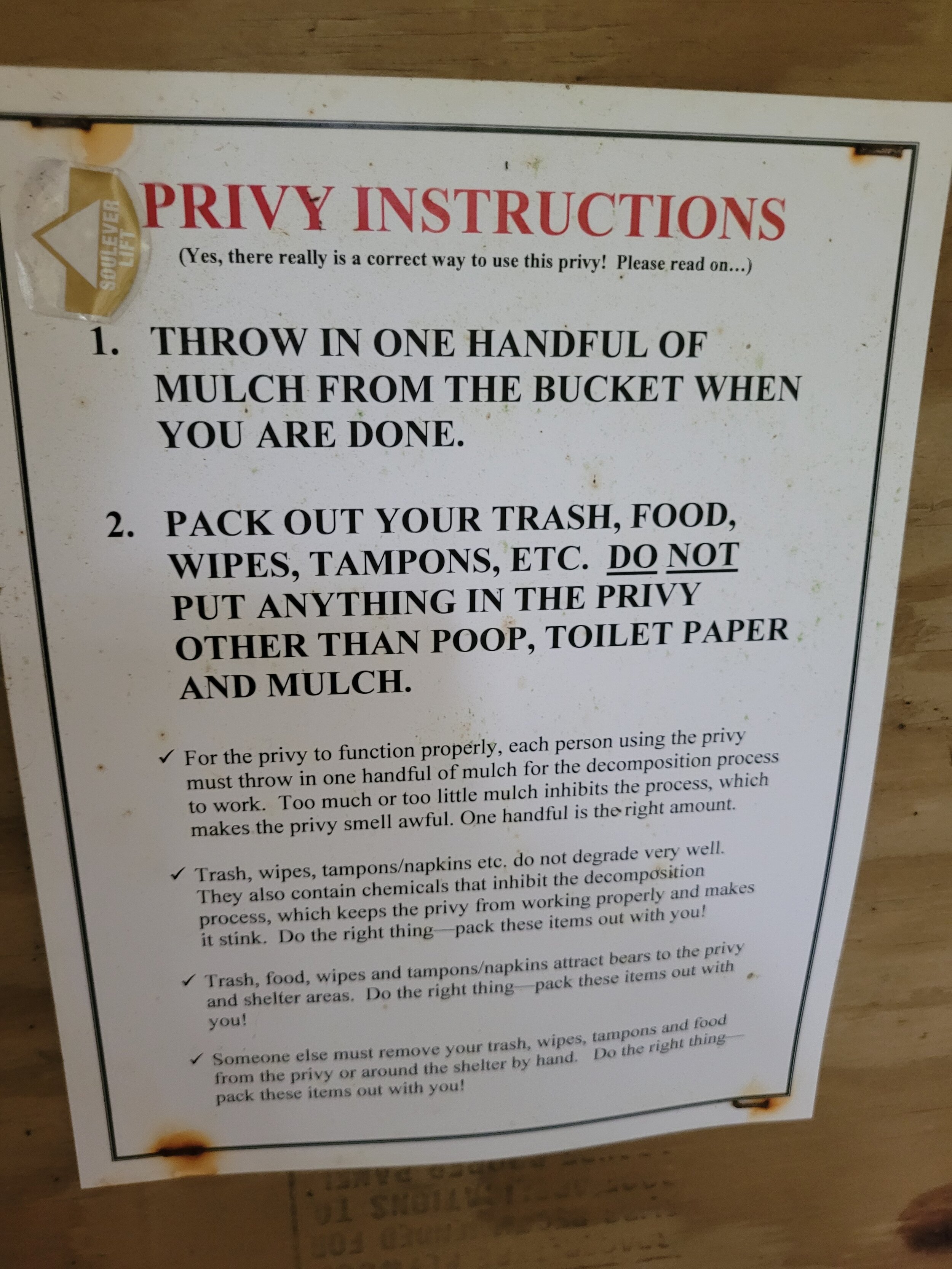
Privies in the Smokies generally consist of a raised wooden platform. Around the base of the Privy there is hardware cloth to keep critters out. There are wooden sides for privacy and a stool. You simply sit on the stool and do your business. When you are done you toss in one handful of mulch, which aids on the composting of your poop and prevents it from smelling. However, as I said, this shelter does not have one of those. Instead, there is a trail that leads away from camp to a spot for hikers to dig a cat hole in the rocky ground, at least six inches deep, to bury their poop. You want to be far enough away from camp so you cannot really see the shelter. Since the soil is so rocky, this is a challenging task. It's the only option, so far from camp, I dig a 6-inch cat-hole near a tree. Then, facing the tree I hold onto the tree as a squat and do my thing. I use my last little bit of toilet paper from when I started the trail and buried it all so no one needs to ever see it. I placed two small sticks to form an x, so the next person does not choose this exact spot and starts digging. This is the accepted way to use the bathroom in this area.
I suffered from a common hiker malady called monkey butt, which is basically chafing between the butt cheeks. Hey, I sweat a lot. I had asked one of the other hikers, who happened to be a nurse, what she recommends. She had some zinc oxide, diaper rash cream. She gave me some in a plastic baggy and it was very effective. I thanked her very much and I will have to pack a tube next time I go backpacking.
Also at this shelter, there was a grandpa and his teenage grandson hiking the same section as me. They started this morning. The grandfather is a former thru-hiker. They are from Alabama.
I went to bed alone in the shelter after taking a couple Benadryl to help me sleep. Not because I was itching, but because it is so hard to fall asleep in the woods. Before I fell asleep, I heard two other hikers arrive at the shelter, but I was down for the count and couldn't even summon enough energy to say hello.
The next morning, I discovered that that spool of toilet paper I took from the outhouse at Clingmans Dome had been partially eaten by a mouse. I had placed it by where I slept for easy access in case I had to go in the middle of the night. I ate breakfast, packed up, and headed out for the day.
On the third day of my hike, I had to hike from Silers Bald shelter to Spence Field. The distance between the two is about 12 miles. It was the day with the most ups and down and the most difficult sections of trail of my whole trip.
I started the day with a descent into Buckeye Gap -- a gap is the low point between two mountains. I play leapfrog with the grandfather and grandson for a while until we met up at Derrick Knob Shelter. It has been about 5.7 miles since I started that morning, so I filled up on water from their very nice water source. At the shelter, there was another thru-hiker, who was taking a zero day at the shelter because he hurt his ankle and wanted to give it a bit more rest. A zero day is a day that you hike zero miles. I also met a trail runner taking a break at the shelter. She started at Clingmans Dome, she said she was meeting up with a thru-hiker heading north to deliver them beer. As I was filling up my water, the grandfather and grandson continued on their Hill hike, and I would not see them again during my trip.
When I came across northbound hikers, they all warned me about rattlesnakes up ahead. I thought it would be cool to see rattlesnakes, but they kind of frighten me a bit. I knew that if so many northbound hikers saw the snakes and nothing bad happened, I was probably going to be ok. Still, the thought of “what if” hung around in my mind. They also told me about the mother and her two children who were hiking the first 200 miles of the AT from Mt Springer to Clingmans Dome. I have no clue how someone can keep their two young girls motivated to hike 200 miles, but when I met up with them, they seemed energetic and happy. The mother had also heard about the rattlesnakes and asked me if I saw them. I confessed that I had not.
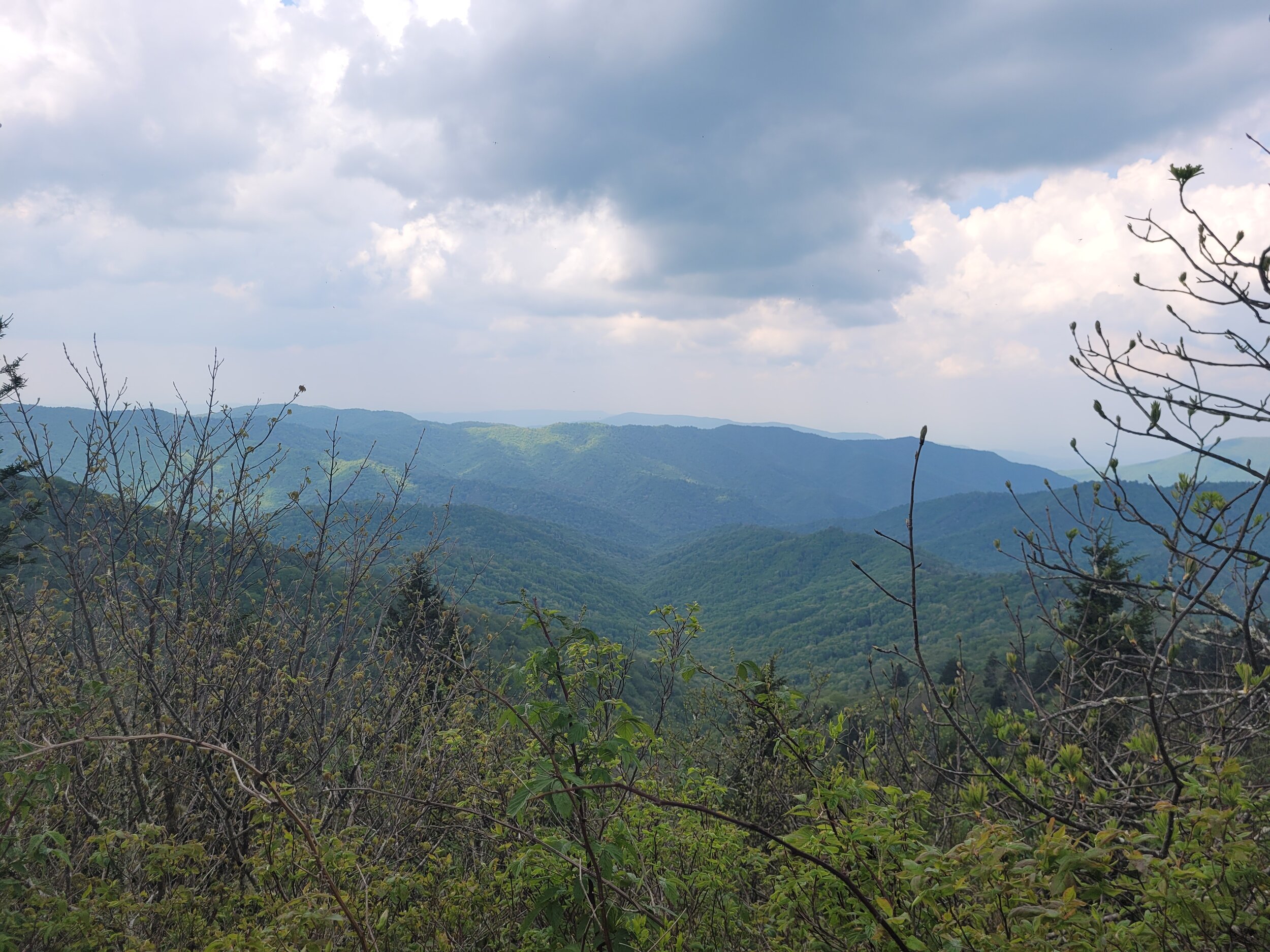
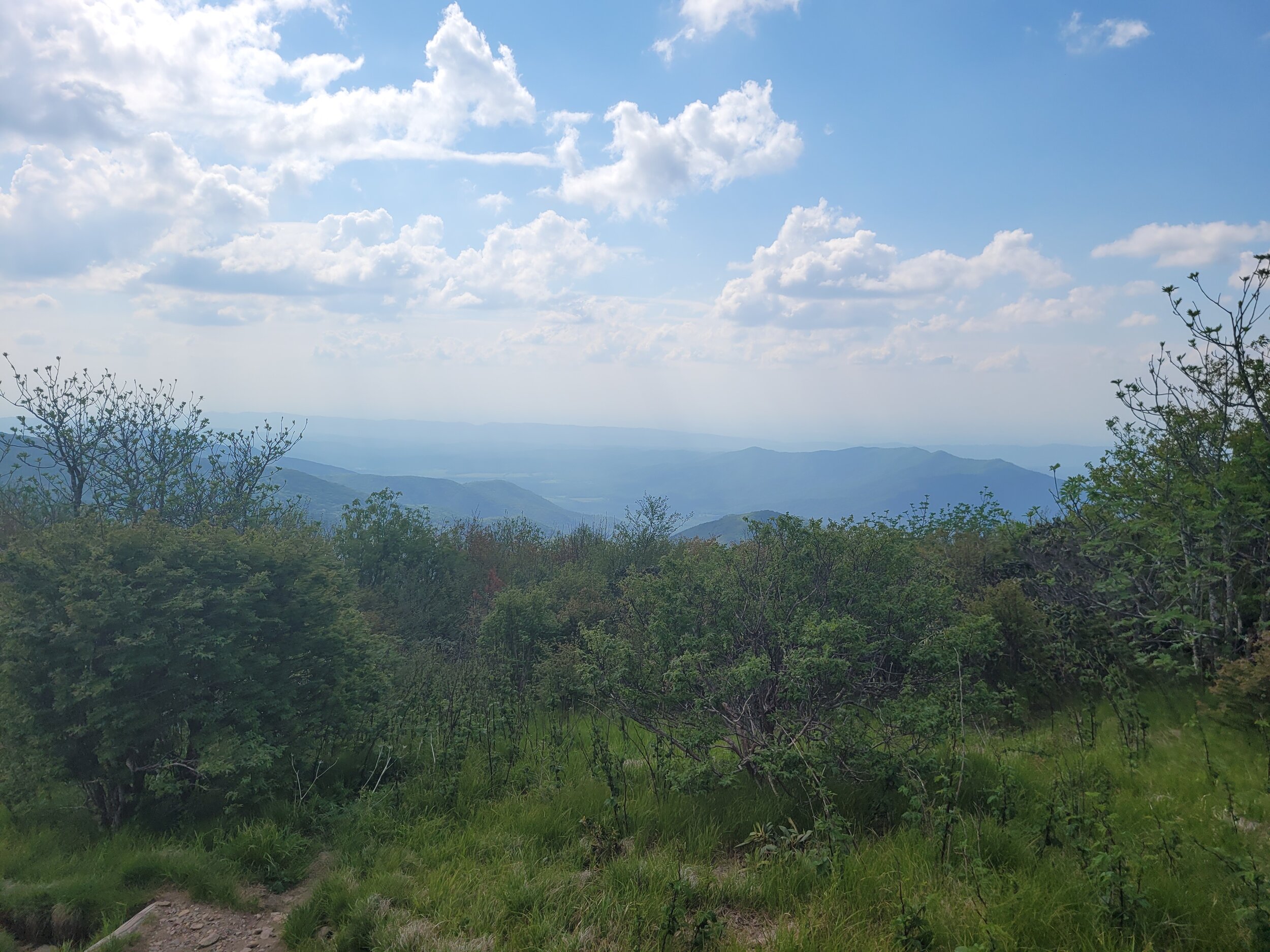
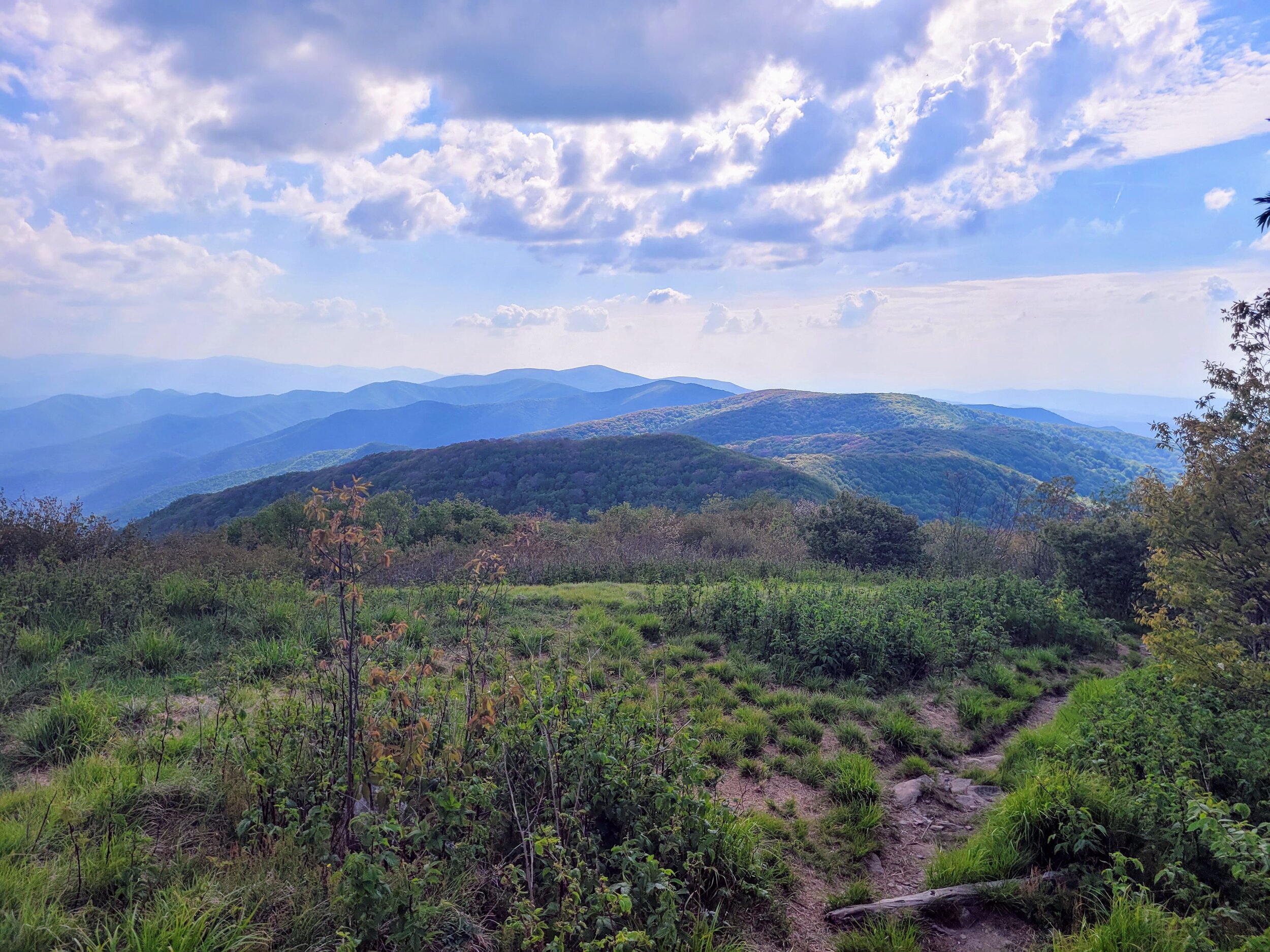
My hike was going pretty well through Starkey Gap, but after Starky, I had to ascend the second highest peak of my trip, Thunderhead Mountain. Thunderhead Mountain has a peak of 5527 feet above sea level and a steep rocky climb to get there. My feet were sore as were my knees. I popped a few ibuprofens (aka “vitamin I”) on the trail, so I could keep going. It helped with my knee but not my feet. When I finally got to the top of Thunderhead Mountain, I was greeted with some of my favorite views of my hike. After a slight descent from Thunderhead I reached Rocky Top about a half mile up the trail on the same ridgeline at 5441 feet, which presented lovely views as well. I took a long break to admire the view which seemed to go on for miles in the solitude. On the way down I took a small tumble which I slightly bent a trekking pole where it won’t collapse into itself very easily to put away. I was not hurt other than a small scrape. I continued down to the last shelter of my trip, Spence Field.
The first thing I noticed at Spence Field was how open and clean it was. They had built a brand-new privy and the water source flowed pretty well. There were some people chatting in the shelter. There was a father daughter pair attempting a thru-hike, but the daughter was complaining about her knee pain after an injury earlier on the trail. I shared the shelter with one other gentleman who came up from Fontana Dam that morning and was planning on hiking either to Newfound Gap, where I started a few days before, or to hike through the whole Smoky section. We had a conversation before bed, he told me what to expect for my last day and assured me it would be easy.
The next morning, I opened my food bag to see all the food I still had left, since this was my last day and I had 18 miles to go, it felt prudent to shed weight, so I offered all my extra food to the other hikers and off I went for an 18 mile day.
I started at a quarter to eight in the morning, which was later than I planned. I made pretty good time passing Russell Field Shelter. I arrived at Mollies Ridge Shelter by 10:30 in the morning. I felt pretty good. I stopped at Mollies’ for a snickers bar and a drink. I met a nice woman there, who was having some issues with her filter. I hope she figured that out. Before too long, I started to go down to Ekaneetle Gap where I was able to refill water for the final time on the trail.
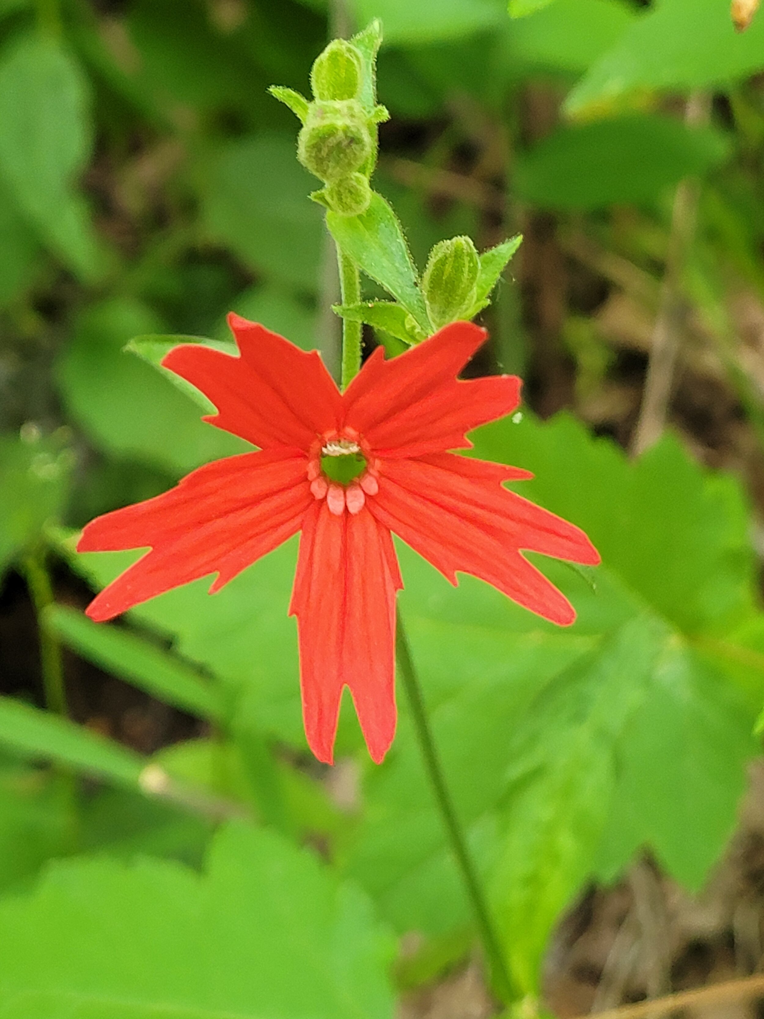
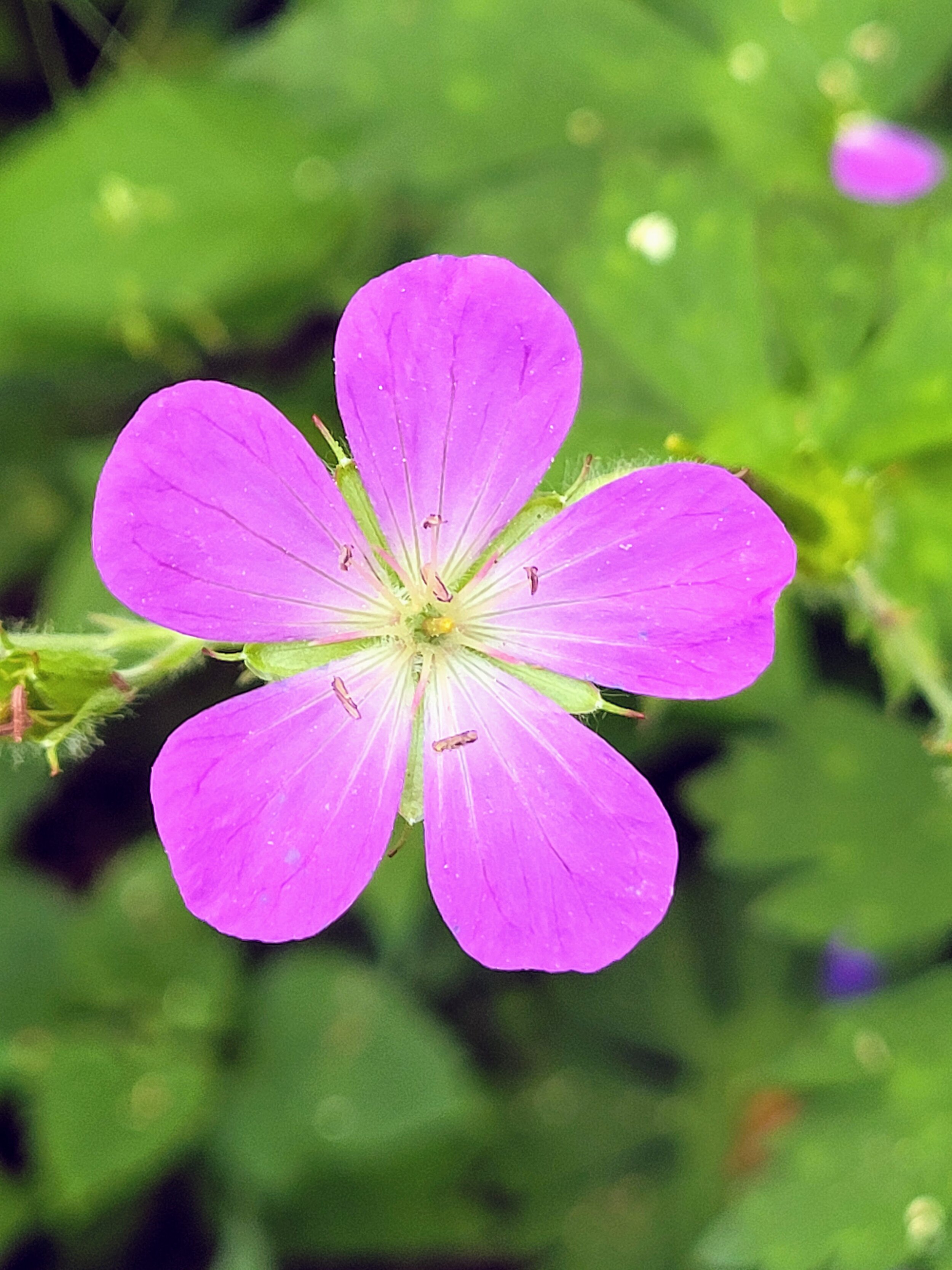
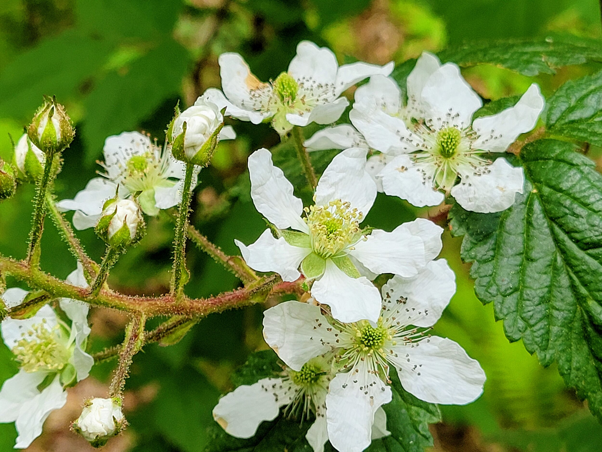
I did not stop for many breaks, or take many photos. I kept popping Advil like candy with an occasional Tylenol thrown in as well. I was slowing way down. Under 1 mile per hour at times. The trail was not very hard, but it was long and I was already sore. There were a ton of wildflowers on this section of the trail. I kept hearing how great the views were on top of Shuckstack, a fire tower, but I simply did not have the time, or desire to stop with how sore my feet were. I kept hiking. I sped up as Guthook’s, a phone app which tells you information about the trail, counted down the miles to Fontana Dam Visitor Center, where I left my car. This part of the trail was all downhill through switchbacks on the side of the mountain. The relief I felt when I reached the small road one mile from my car was immense. I walked down the road and across the dam and reached my car at just about 8pm.
Before I went on this trip, when I told people I was going, and that I was going alone, they were amazed that I would go alone. I feel they envision me being out in the middle of the woods alone for days at a time. However, the reality is that I am always passing by someone, and there is always someone at the shelters. In 2020 the park service estimated that 12.1 million people visited the park that year. It is the most visited national park in the United States. Hikers tend to look out for each other and lend a helping hand where we can.
This was by far the most intense backpacking trip I have ever done. Every trip I go on I try to push the envelope in some way. I pushed myself to do more miles, on a more difficult part of the trail. But the trail proved to be even more difficult than I planned. I am proud of myself for doing it even though I had doubts at times and was frustrated. There were not as many views as there were on my 2018 trip, but the views were every bit as good. I will be back to the Smokies in the future.